The Trail
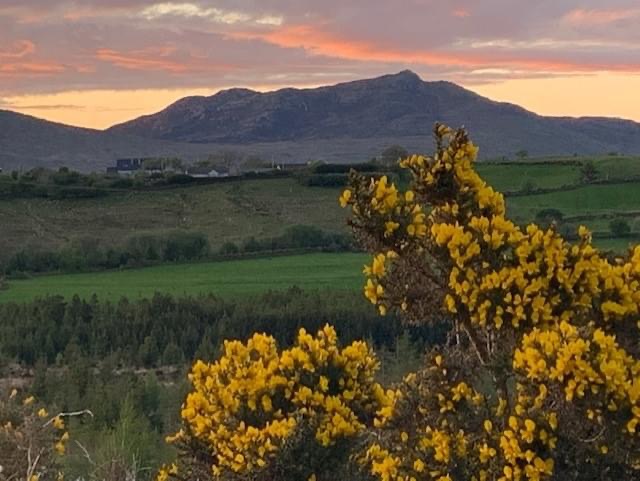
The main Bluestack Way trail is 48Km, but increases to 65Km when the alternative poor weather section is included. The trail brings the walker through the beautiful countryside of the Bluestack mountains, a range of lowland rounded hills, in South Donegal, Ireland.
Beginning in the centre of Donegal Town at 'The Diamond' the trail leads you along country roads to the scenic Lough Eske in the Bluestack mountains.
From here, follow the trail through the foothills of the Bluestacks to the ancient graveyard at 'Disert'.
West of Disert the route goes over rough and remote high moorland terrain between Binbane and Cloghmeen Hill before descending along the Owenroe river to reach a bog road. This is followed across isolated bogland at Meenawannia to reach Glenties
(An alternative fair weather route leads you around the western end of the bluestacks to rejoin the trail north of the mountains).
The final section of the trail leads you on a riverside walk, along the Owenea river to arrive in the heritage town of Ardara.
Grade: Moderate. (Explained below).
Length: 65 Km.
Format: Linear.
Time to complete: 3 Days
Aggregate Ascent: 1430mts. - But other than the stretch up onto the pass between Binbane and Cloghmeen Hill, there are no significant climbs.
Dogs allowed: No.
Waymarking: Yellow arrow on black background.
Trail Grading Explained - Sport Ireland.
Multi-access.
Routes must be flat, have no obstacles such as gates, steps, stiles etc.
All users including people with reduced mobility, wheelchair users, people with a vision impairment, using crutches, with a buggy, with small children, older people and so on. Normal outdoor footwear can be worn.
Easy.
Will include either Class 1 or Class 2 trails and flat sections of Class 3 and Class 4 trails. Routes can include some obstacles such as stiles, gates, steps etc. but these must be minimal. Should only have gentle slopes with no continuous climbing on the route.
Family groups including children and the elderly. May be suitable for parents with buggies (should be denoted at trail head) or very small children. Normal outdoor footwear can be worn.
Moderate.
Will include predominantly Class 3 trails but can include sections of Class 1, Class 2 or Class 4 Trails (typically for no more 30% of the route distance). Overall the route will have rough underfoot conditions and may include uphill sections taking up to 10 minutes to walk. Note: in the case of exposed trails which may be exposed to poor weather, consideration should be given to moving the grading up a level.
People with a moderate level of fitness. Specific outdoor walking footwear and clothing required.
Strenuous.
This will include predominantly Class 4 Trails but can include sections of Class 1, Class 2 or Class 3 trails (typically for no more 30% of the route distance). Overall the route will have moderately steep climbs for long sections (up to 20 mins). The going underfoot can be extremely rough and can include many obstacles.
People accustomed to walking rough trails and with a high level of fitness. Typically all day or multiday walkers. Specific outdoor walking footwear and clothing required.
Very Difficult.
This will include predominantly Class 5 Trails but can include Class 1, Class 2 or Class 3 or 4 trails in the route, (typically for no more 30% of the route distance). Overall the route will have difficult underfoot conditions, and may include long sections of ascent up to 1 hr duration. Can include exposed terrain
Only suitable for people accustomed to walking in remote areas and with a high level of fitness and navigation skills. Typically all day or multiday walkers. Specific outdoor walking footwear and clothing required